
South Saint Paul topographic map
Interactive map
Click on the map to display elevation.
About this map
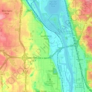
Name: South Saint Paul topographic map, elevation, terrain.
Average elevation: 257 m
Minimum elevation: 207 m
Maximum elevation: 331 m
Other topographic maps
Click on a map to view its topography, its elevation and its terrain.
Farmington
United States > Minnesota > Dakota County > Farmington > Farmington
Average elevation: 280 m
Burnsville
United States > Minnesota > Dakota County > Burnsville > Burnsville
Average elevation: 275 m