
Rashil topographic map
Interactive map
Click on the map to display elevation.
About this map
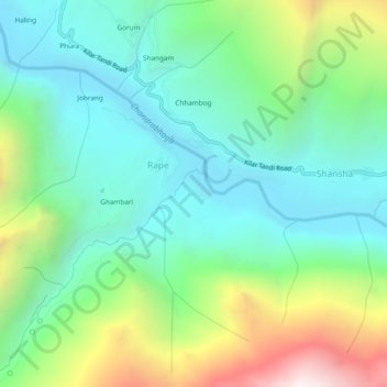
Name: Rashil topographic map, elevation, terrain.
Location: Rashil, Rape, Lahul, Lahul and Spiti, Himachal Pradesh, India (32.59409 76.86420 32.63409 76.90420)
Average elevation: 3,261 m
Minimum elevation: 2,753 m
Maximum elevation: 4,499 m