
Hanchir Toumghani topographic map
Interactive map
Click on the map to display elevation.
About this map
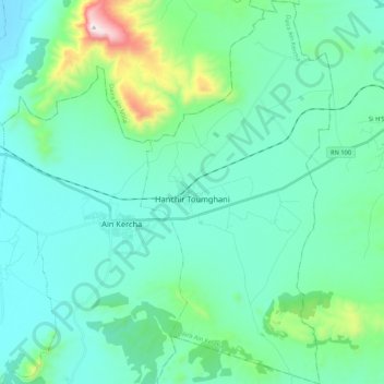
Name: Hanchir Toumghani topographic map, elevation, terrain.
Location: Hanchir Toumghani, Aïn Kechra District, Oum El Bouaghi, Algeria (35.85180 6.71258 36.02336 6.81911)
Average elevation: 921 m
Minimum elevation: 765 m
Maximum elevation: 1,724 m