
Shinfield topographic map
Interactive map
Click on the map to display elevation.
About this map
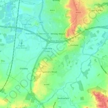
Name: Shinfield topographic map, elevation, terrain.
Average elevation: 50 m
Minimum elevation: 33 m
Maximum elevation: 90 m
Other topographic maps
Click on a map to view its topography, its elevation and its terrain.
Ryeish Green
United Kingdom > England > Borough of Wokingham > Three Mile Cross
Ryeish Green, Shinfield, Three Mile Cross, Borough of Wokingham, England, RG7 1ET, United Kingdom
Average elevation: 49 m