
Oujda topographic map
Interactive map
Click on the map to display elevation.
About this map
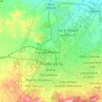
Name: Oujda topographic map, elevation, terrain.
Average elevation: 566 m
Minimum elevation: 486 m
Maximum elevation: 725 m
The city is located 60 km (37 mi) south of the Mediterranean sea and 15 km (9 mi) west of Algeria, with an estimated altitude of 450 metres (1,476 feet).