
Williams County topographic map
Interactive map
Click on the map to display elevation.
About this map
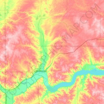
Name: Williams County topographic map, elevation, terrain.
Location: Williams County, North Dakota, United States (47.95452 -104.04821 48.63486 -102.82892)
Average elevation: 663 m
Minimum elevation: 556 m
Maximum elevation: 778 m
Other topographic maps
Click on a map to view its topography, its elevation and its terrain.
Williston
United States > North Dakota > Williams County
Williston, Williams County, North Dakota, United States
Average elevation: 603 m