
Roberta topographic map
Interactive map
Click on the map to display elevation.
About this map
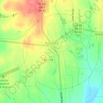
Name: Roberta topographic map, elevation, terrain.
Location: Roberta, Crawford County, Georgia, United States (32.70989 -84.02207 32.72958 -83.99845)
Average elevation: 149 m
Minimum elevation: 114 m
Maximum elevation: 187 m