
Reddish Knob topographic map
Interactive map
Click on the map to display elevation.
About this map
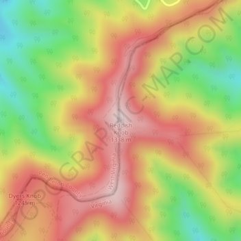
Name: Reddish Knob topographic map, elevation, terrain.
Location: Reddish Knob, Augusta County, Virginia, United States (38.46255 -79.24171 38.46265 -79.24161)
Average elevation: 1,120 m
Minimum elevation: 871 m
Maximum elevation: 1,322 m
Other topographic maps
Click on a map to view its topography, its elevation and its terrain.
Churchville
United States > Virginia > Augusta County
Churchville, Augusta County, Virginia, 24421, United States
Average elevation: 467 m
Annex
United States > Virginia > Augusta County
Annex, Augusta County, Virginia, 24482, United States
Average elevation: 393 m
Copelands Tetons
United States > Virginia > Augusta County
Copelands Tetons, Augusta County, Virginia, 22980-4738, United States
Average elevation: 573 m