
Duxbury topographic map
Interactive map
Click on the map to display elevation.
About this map
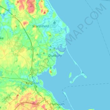
Name: Duxbury topographic map, elevation, terrain.
Location: Duxbury, Plymouth County, Massachusetts, United States (41.98746 -70.78145 42.09698 -70.52832)
Average elevation: 13 m
Minimum elevation: -1 m
Maximum elevation: 84 m
Other topographic maps
Click on a map to view its topography, its elevation and its terrain.
Tarkiln
United States > Massachusetts > Plymouth County > Duxbury
Tarkiln, Duxbury, Plymouth County, Massachusetts, 02331, United States
Average elevation: 30 m