
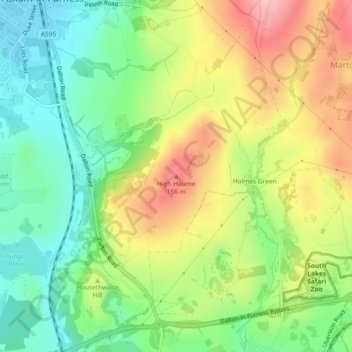
High Haume topographic map
Interactive map
Click on the map to display elevation.
About this map
Name: High Haume topographic map, elevation, terrain.
Average elevation: 81 m
Minimum elevation: 12 m
Maximum elevation: 174 m
Other topographic maps
Click on a map to view its topography, its elevation and its terrain.
Isle of Walney
United Kingdom > England > Cumbria > Barrow-in-Furness > Biggar
Isle of Walney, Biggar, Barrow-in-Furness, Cumbria, North West England, England, United Kingdom
Average elevation: 8 m
Newton-in-Furness
United Kingdom > England > Cumbria > Barrow-in-Furness
Newton-in-Furness, Barrow-in-Furness, Cumbria, England, LA13 0NA, United Kingdom
Average elevation: 51 m