
Town of Lexington topographic map
Interactive map
Click on the map to display elevation.
About this map
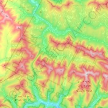
Name: Town of Lexington topographic map, elevation, terrain.
Location: Town of Lexington, Greene County, New York, United States (42.11281 -74.48541 42.28905 -74.23940)
Average elevation: 657 m
Minimum elevation: 292 m
Maximum elevation: 1,176 m
Other topographic maps
Click on a map to view its topography, its elevation and its terrain.
West Kill
United States > New York > Greene County > Town of Lexington
West Kill, Town of Lexington, Greene County, New York, 12492, United States
Average elevation: 664 m