
Benenden topographic map
Interactive map
Click on the map to display elevation.
About this map
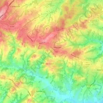
Name: Benenden topographic map, elevation, terrain.
Location: Benenden, Tunbridge Wells, Kent, England, United Kingdom (51.03761 0.53072 51.09144 0.64664)
Average elevation: 61 m
Minimum elevation: 0 m
Maximum elevation: 125 m