
Chigubo topographic map
Interactive map
Click on the map to display elevation.
About this map
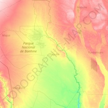
Name: Chigubo topographic map, elevation, terrain.
Location: Chigubo, Gaza Province, Mozambique (-23.95290 33.01356 -21.97767 33.95046)
Average elevation: 107 m
Minimum elevation: 25 m
Maximum elevation: 243 m
Other topographic maps
Click on a map to view its topography, its elevation and its terrain.