Stony Fork Junction topographic map
Interactive map
Click on the map to display elevation.
About this map
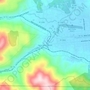
Name: Stony Fork Junction topographic map, elevation, terrain.
Average elevation: 452 m
Minimum elevation: 345 m
Maximum elevation: 762 m

Click on the map to display elevation.
Name: Stony Fork Junction topographic map, elevation, terrain.
Average elevation: 452 m
Minimum elevation: 345 m
Maximum elevation: 762 m