
Avon topographic map
Interactive map
Click on the map to display elevation.
About this map
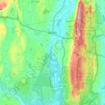
Name: Avon topographic map, elevation, terrain.
Location: Avon, Capitol Region COG, Connecticut, 06001, United States (41.75790 -72.92784 41.82496 -72.79675)
Average elevation: 104 m
Minimum elevation: 38 m
Maximum elevation: 281 m
Other topographic maps
Click on a map to view its topography, its elevation and its terrain.
Canton Valley
United States > Connecticut > Capitol Region COG > Canton
Canton Valley, Canton, Capitol Region COG, Connecticut, United States
Average elevation: 148 m
Hydeville Pond Dam
United States > Connecticut > Capitol Region COG > Stafford > Staffordville > Hydeville
Hydeville Pond Dam, Hydeville, Staffordville, Stafford, Capitol Region COG, Connecticut, 06077, United States
Average elevation: 227 m