
Burkes Garden topographic map
Interactive map
Click on the map to display elevation.
About this map
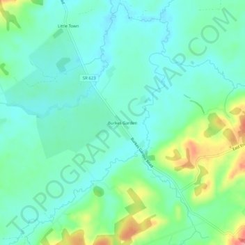
Name: Burkes Garden topographic map, elevation, terrain.
Average elevation: 947 m
Minimum elevation: 922 m
Maximum elevation: 1,017 m
Other topographic maps
Click on a map to view its topography, its elevation and its terrain.
Liberty
United States > Virginia > Tazewell County
Liberty, Tazewell County, Virginia, United States
Average elevation: 832 m
Pucketts Store
United States > Virginia > Tazewell County
Pucketts Store, Tazewell County, Virginia, 24377, United States
Average elevation: 923 m
Indian
United States > Virginia > Tazewell County > Cedar Bluff
Indian, Cedar Bluff, Tazewell County, Virginia, 24609, United States
Average elevation: 681 m
Richlands
United States > Virginia > Tazewell County
Richlands, Tazewell County, Virginia, United States
Average elevation: 671 m