
Aïn Azal topographic map
Interactive map
Click on the map to display elevation.
About this map
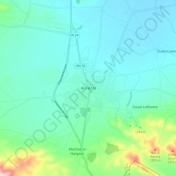
Name: Aïn Azal topographic map, elevation, terrain.
Location: Aïn Azal, Ain Azal District, Setif, 19007, Algeria (35.77785 5.47119 35.85785 5.55119)
Average elevation: 981 m
Minimum elevation: 909 m
Maximum elevation: 1,303 m