
Granby topographic map
Interactive map
Click on the map to display elevation.
About this map
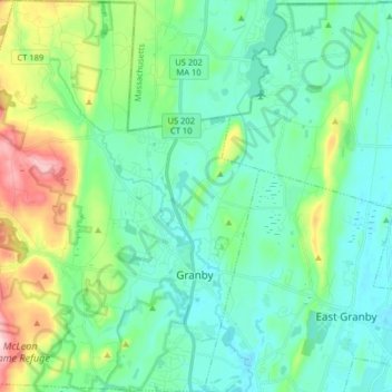
Name: Granby topographic map, elevation, terrain.
Location: Granby, Hartford County, Connecticut, United States (41.91829 -72.90659 42.03753 -72.76300)
Average elevation: 107 m
Minimum elevation: 40 m
Maximum elevation: 330 m