Geolocate

Vahal Village topographic map

Interactive map

Click on the map to display elevation.

About this map

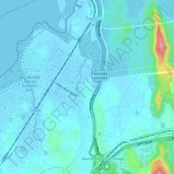
Name: Vahal Village topographic map, elevation, terrain.

Location: Vahal Village, Panvel, Raigad, Maharashtra, 400614, India (18.95603 73.01409 18.99603 73.05409)

Average elevation: 13 m

Minimum elevation: -5 m

Maximum elevation: 129 m

Other topographic maps

Click on a map to view its topography, its elevation and its terrain.

Patalganga

India > Maharashtra > Panvel > Apta

Patalganga, Apta, Panvel, Raigad, Maharashtra, India

Average elevation: 85 m

Apta

India > Maharashtra > Panvel

Apta, Panvel, Raigad, Maharashtra, 410207, India

Average elevation: 64 m

Mumbai Metropolitan Region

India > Maharashtra > Panvel

Mumbai Metropolitan Region, Panvel, Raigad, Maharashtra, India

Average elevation: 143 m

Patalganga

India > Maharashtra > Panvel

Patalganga, Mumbai Metropolitan Region, Panvel, Raigad, Maharashtra, 410207, India

Average elevation: 13 m

Kopra Village

India > Maharashtra > Panvel > Panvel

Kopra Village, Panvel, Raigad, Maharashtra, 400056, India

Average elevation: 13 m