
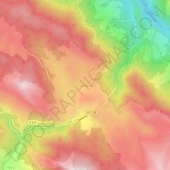
Čemerno topographic map
Interactive map
Click on the map to display elevation.
About this map
Name: Čemerno topographic map, elevation, terrain.
Average elevation: 1,262 m
Minimum elevation: 821 m
Maximum elevation: 1,531 m
Čemerno (Serbian Cyrillic: Чемерно) is a mountain in western Serbia, near the town of Ivanjica. Its highest peak Smrdljuč has an elevation of 1,579 m (5,180 ft) above sea level.