
Thank you for supporting this site ❤️
Make a donation
Make a donation
Gear up for your next adventure:
As an Amazon Associate, this site earns from qualifying purchases at no extra cost to you.
R'mali topographic map
Click on the map to display elevation.
Thank you for supporting this site ❤️
Make a donation
Make a donation
Gear up for your next adventure:
As an Amazon Associate, this site earns from qualifying purchases at no extra cost to you.
About this map
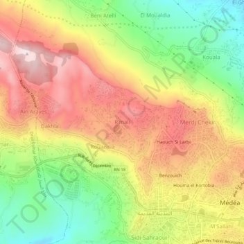
Name: R'mali topographic map, elevation, terrain.
Location: R'mali, Médéa, Medea District, Médéa, 2600, Algeria (36.25857 2.72504 36.29857 2.76504)
Average elevation: 908 m
Minimum elevation: 699 m
Maximum elevation: 1,105 m
Thank you for supporting this site ❤️
Make a donation
Make a donation
Gear up for your next adventure:
As an Amazon Associate, this site earns from qualifying purchases at no extra cost to you.