
Gerihun topographic map
Interactive map
Click on the map to display elevation.
About this map
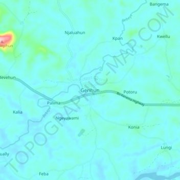
Name: Gerihun topographic map, elevation, terrain.
Location: Gerihun, Bo District, Southern Province, Sierra Leone (7.89094 -11.61831 7.97094 -11.53831)
Average elevation: 102 m
Minimum elevation: 85 m
Maximum elevation: 273 m