
Hall Ing topographic map
Interactive map
Click on the map to display elevation.
About this map
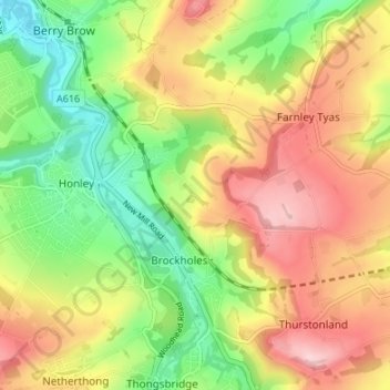
Name: Hall Ing topographic map, elevation, terrain.
Average elevation: 184 m
Minimum elevation: 81 m
Maximum elevation: 295 m
Other topographic maps
Click on a map to view its topography, its elevation and its terrain.
Holmfirth Branch
United Kingdom > England > Kirklees > Brockholes
Holmfirth Branch, New Mill Road, Holme Valley, Brockholes, Kirklees, West Yorkshire, Yorkshire and the Humber, England, HD9 7BD, United Kingdom
Average elevation: 185 m