
Montleban topographic map
Interactive map
Click on the map to display elevation.
About this map
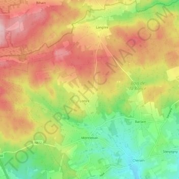
Name: Montleban topographic map, elevation, terrain.
Location: Montleban, Gouvy, Bastogne, Luxembourg, Wallonia, 6670, Belgium (50.17373 5.78809 50.23999 5.88033)
Average elevation: 509 m
Minimum elevation: 396 m
Maximum elevation: 627 m