
Valle Crucis topographic map
Interactive map
Click on the map to display elevation.
About this map
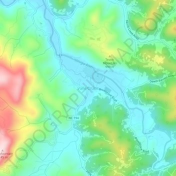
Name: Valle Crucis topographic map, elevation, terrain.
Average elevation: 904 m
Minimum elevation: 803 m
Maximum elevation: 1,153 m
Valle Crucis is located at the banks of Dutch Creek and Watauga River, at an elevation of 2,677 feet (816 m) above sea level. To its north and east is Tester Mountain and to its south and west is Valle Mountain. The community is also within the Pisgah National Forest boundary, which limits some development in the area.