
Calimanesti topographic map
Interactive map
Click on the map to display elevation.
About this map
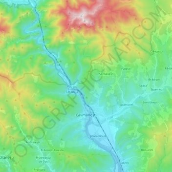
Name: Calimanesti topographic map, elevation, terrain.
Location: Calimanesti, Vâlcea, Romania (45.20444 24.19761 45.32314 24.39935)
Average elevation: 625 m
Minimum elevation: 260 m
Maximum elevation: 1,635 m
Other topographic maps
Click on a map to view its topography, its elevation and its terrain.