
Depoe Bay topographic map
Interactive map
Click on the map to display elevation.
About this map
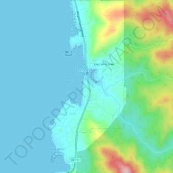
Name: Depoe Bay topographic map, elevation, terrain.
Location: Depoe Bay, Lincoln County, Oregon, United States (44.78707 -124.07425 44.82617 -124.04999)
Average elevation: 48 m
Minimum elevation: -2 m
Maximum elevation: 236 m