
Harsewinkel topographic map
Interactive map
Click on the map to display elevation.
About this map
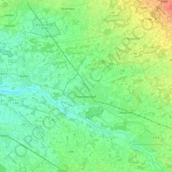
Name: Harsewinkel topographic map, elevation, terrain.
Average elevation: 69 m
Minimum elevation: 55 m
Maximum elevation: 99 m
Other topographic maps
Click on a map to view its topography, its elevation and its terrain.
Emsquelle
Germany > North Rhine-Westphalia > Kreis Gütersloh > Schloß Holte-Stukenbrock
Emsquelle, Panzerringstraße, Stukenbrock-Senne, Stukenbrock, Schloß Holte-Stukenbrock, Kreis Gütersloh, North Rhine-Westphalia, 33161, Germany
Average elevation: 135 m
Verl
Germany > North Rhine-Westphalia > Kreis Gütersloh
Verl, Kreis Gütersloh, North Rhine-Westphalia, 33415, Germany
Average elevation: 93 m
Gütersloh
Germany > North Rhine-Westphalia > Kreis Gütersloh
Gütersloh, Kreis Gütersloh, North Rhine-Westphalia, Germany
Average elevation: 80 m