
Thandla topographic map
Interactive map
Click on the map to display elevation.
About this map
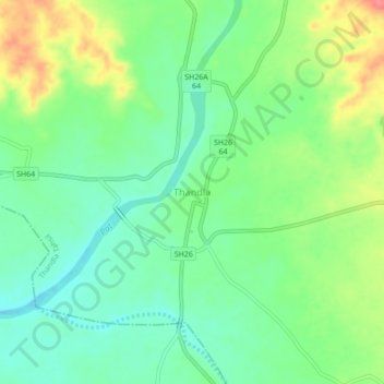
Name: Thandla topographic map, elevation, terrain.
Location: Thandla, Thandla Tahsil, Jhabua, Madhya Pradesh, 457777, India (22.99012 74.55713 23.03012 74.59713)
Average elevation: 305 m
Minimum elevation: 280 m
Maximum elevation: 348 m