
Kalviyankadu topographic map
Interactive map
Click on the map to display elevation.
About this map
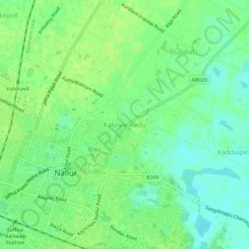
Name: Kalviyankadu topographic map, elevation, terrain.
Location: Kalviyankadu, Jaffna District, Northern Province, 7, Sri Lanka (9.66127 80.01864 9.70127 80.05864)
Average elevation: 8 m
Minimum elevation: 1 m
Maximum elevation: 12 m