
Pass dal Güglia topographic map
Interactive map
Click on the map to display elevation.
About this map
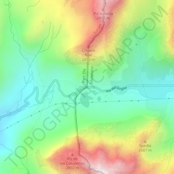
Name: Pass dal Güglia topographic map, elevation, terrain.
Location: Pass dal Güglia, Surses, Albula, Grisons, 7515, Switzerland (46.47217 9.72806 46.47227 9.72816)
Average elevation: 2,443 m
Minimum elevation: 2,138 m
Maximum elevation: 2,950 m
Other topographic maps
Click on a map to view its topography, its elevation and its terrain.
Savognin
Switzerland > Grisons > Surses > Savognin
Savognin, Surses, Albula, Grisons, 7460, Switzerland
Average elevation: 1,461 m
Rodas
Switzerland > Grisons > Surses > Rodas
Rodas, Surses, Albula, Grisons, 7460, Switzerland
Average elevation: 1,602 m