
尉氏县 topographic map
Interactive map
Click on the map to display elevation.
About this map
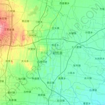
Name: 尉氏县 topographic map, elevation, terrain.
Location: 尉氏县, 开封市, 河南省, 中国 (34.19523 113.86551 34.61866 114.43697)
Average elevation: 77 m
Minimum elevation: 59 m
Maximum elevation: 155 m
Other topographic maps
Click on a map to view its topography, its elevation and its terrain.