
Tashi Dzom topographic map
Interactive map
Click on the map to display elevation.
About this map
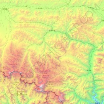
Name: Tashi Dzom topographic map, elevation, terrain.
Location: Tashi Dzom, Tingri County, Shigatse, Tibet, China (27.98784 86.37326 28.52537 87.27179)
Average elevation: 5,001 m
Minimum elevation: 2,696 m
Maximum elevation: 8,716 m