
Mustang topographic map
Interactive map
Click on the map to display elevation.
About this map
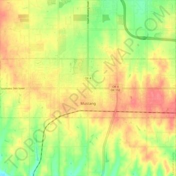
Name: Mustang topographic map, elevation, terrain.
Location: Mustang, Canadian County, Oklahoma, 73064, United States (35.37712 -97.77783 35.40637 -97.67135)
Average elevation: 403 m
Minimum elevation: 368 m
Maximum elevation: 431 m