
Thank you for supporting this site ❤️
Make a donation
Make a donation
Gear up for your next adventure:
As an Amazon Associate, this site earns from qualifying purchases at no extra cost to you.
Vrpolje topographic map
Click on the map to display elevation.
Thank you for supporting this site ❤️
Make a donation
Make a donation
Gear up for your next adventure:
As an Amazon Associate, this site earns from qualifying purchases at no extra cost to you.
About this map
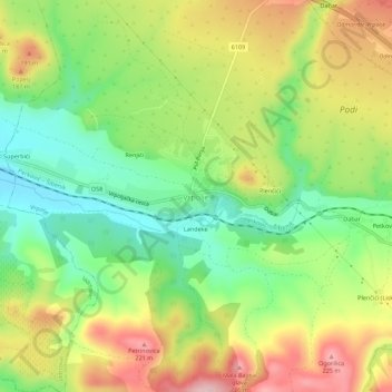
Name: Vrpolje topographic map, elevation, terrain.
Location: Vrpolje, Grad Šibenik, Šibenik-Knin County, Croatia (43.65498 15.99208 43.69498 16.03208)
Average elevation: 112 m
Minimum elevation: 13 m
Maximum elevation: 237 m
Thank you for supporting this site ❤️
Make a donation
Make a donation
Gear up for your next adventure:
As an Amazon Associate, this site earns from qualifying purchases at no extra cost to you.