
Blue River topographic map
Interactive map
Click on the map to display elevation.
About this map
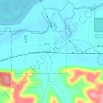
Name: Blue River topographic map, elevation, terrain.
Location: Blue River, Grant County, Wisconsin, United States (43.18011 -90.58188 43.19167 -90.56207)
Average elevation: 223 m
Minimum elevation: 198 m
Maximum elevation: 323 m
Other topographic maps
Click on a map to view its topography, its elevation and its terrain.
Town of Glen Haven
United States > Wisconsin > Grant County
Town of Glen Haven, Grant County, Wisconsin, 53810, United States
Average elevation: 262 m
Muscoda
United States > Wisconsin > Grant County
Muscoda, Grant County, Wisconsin, United States
Average elevation: 210 m
Cassville
United States > Wisconsin > Grant County
Cassville, Grant County, Wisconsin, United States
Average elevation: 222 m
Town of Beetown
United States > Wisconsin > Grant County
Town of Beetown, Grant County, Wisconsin, 53802, United States
Average elevation: 281 m