
Azzaba topographic map
Interactive map
Click on the map to display elevation.
About this map
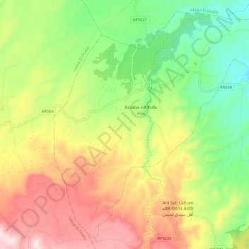
Name: Azzaba topographic map, elevation, terrain.
Average elevation: 795 m
Minimum elevation: 495 m
Maximum elevation: 1,171 m
Other topographic maps
Click on a map to view its topography, its elevation and its terrain.
Barrage Allal Al Fassi
Morocco > Cercle de Sefrou دائرة صفرو > Aghbalou Aqorar
Average elevation: 491 m