
Sanibel topographic map
Interactive map
Click on the map to display elevation.
About this map
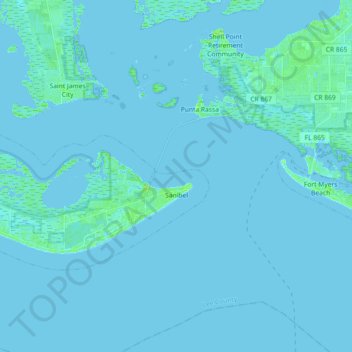
Name: Sanibel topographic map, elevation, terrain.
Location: Sanibel, Lee County, Florida, United States (26.41430 -82.18686 26.50083 -82.00569)
Average elevation: 1 m
Minimum elevation: -1 m
Maximum elevation: 11 m
Other topographic maps
Click on a map to view its topography, its elevation and its terrain.
Sanibel Island
United States > Florida > Lee County > Sanibel
Sanibel Island, Sanibel, Lee County, Florida, 33957, United States
Average elevation: 1 m