
Fountain topographic map
Interactive map
Click on the map to display elevation.
About this map
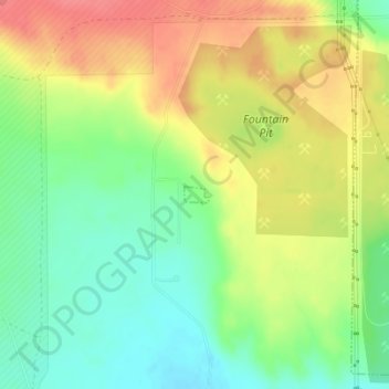
Name: Fountain topographic map, elevation, terrain.
Location: Fountain, El Paso County, Colorado, United States (38.65521 -104.73432 38.65635 -104.73213)
Average elevation: 1,723 m
Minimum elevation: 1,691 m
Maximum elevation: 1,758 m
Other topographic maps
Click on a map to view its topography, its elevation and its terrain.
Fountain
United States > Colorado > El Paso County > Fountain > Fountain
Fountain, El Paso County, Colorado, 8017, United States
Average elevation: 1,714 m