
Horseshoe Bend topographic map
Interactive map
Click on the map to display elevation.
About this map
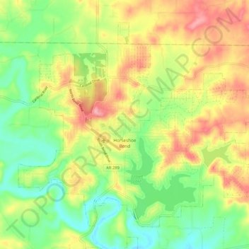
Name: Horseshoe Bend topographic map, elevation, terrain.
Location: Horseshoe Bend, Izard County, Arkansas, 72512, United States (36.19148 -91.79236 36.26120 -91.68736)
Average elevation: 216 m
Minimum elevation: 160 m
Maximum elevation: 284 m
The Horseshoe Bend Airport, FAA identifier is 6M2, is owned and operated by the city. The runway is 4,524 ft. x 60 ft. and is paved.[15] It is located at 36°13′3″N 91°45′3″W / 36.21750°N 91.75083°W / 36.21750; -91.75083 (36.2213694, -91.7554833) at an elevation of 782 ft. / 238 m. Its variation is 03E.[16]
Other topographic maps
Click on a map to view its topography, its elevation and its terrain.
Calico Rock
United States > Arkansas > Izard County
Calico Rock, Izard County, Arkansas, United States
Average elevation: 179 m