
Daleville topographic map
Interactive map
Click on the map to display elevation.
About this map
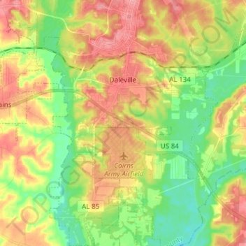
Name: Daleville topographic map, elevation, terrain.
Location: Daleville, Dale County, Alabama, United States (31.23920 -85.75239 31.34402 -85.64129)
Average elevation: 72 m
Minimum elevation: 32 m
Maximum elevation: 115 m
Other topographic maps
Click on a map to view its topography, its elevation and its terrain.
Fort Rucker
United States > Alabama > Dale County > Daleville
Fort Rucker, Daleville, Dale County, Alabama, United States
Average elevation: 99 m
Allen Heights
United States > Alabama > Dale County
Allen Heights, Dale County, Alabama, 36362, United States
Average elevation: 89 m