
Aïn Madhi topographic map
Interactive map
Click on the map to display elevation.
About this map
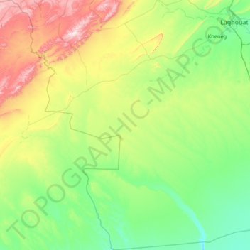
Name: Aïn Madhi topographic map, elevation, terrain.
Location: Aïn Madhi, Aïn Madhi District, Laghouat, Algeria (32.80404 2.08405 33.90085 2.90539)
Average elevation: 910 m
Minimum elevation: 692 m
Maximum elevation: 1,655 m