
Bir El Ater topographic map
Interactive map
Click on the map to display elevation.
About this map
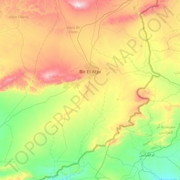
Name: Bir El Ater topographic map, elevation, terrain.
Location: Bir El Ater, Bir Elater District, Tébessa, Algeria (34.40517 7.73286 34.96593 8.30104)
Average elevation: 740 m
Minimum elevation: 329 m
Maximum elevation: 1,482 m