
Norwich topographic map
Interactive map
Click on the map to display elevation.
About this map
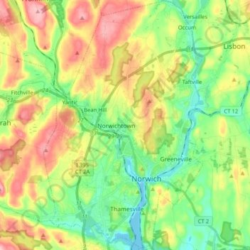
Name: Norwich topographic map, elevation, terrain.
Location: Norwich, New London County, Connecticut, United States (41.49068 -72.14066 41.60803 -72.04032)
Average elevation: 67 m
Minimum elevation: -4 m
Maximum elevation: 165 m
Other topographic maps
Click on a map to view its topography, its elevation and its terrain.
Thames
United States > Connecticut > Norwich
Thames, Norwich, New London County, Connecticut, United States
Average elevation: 61 m