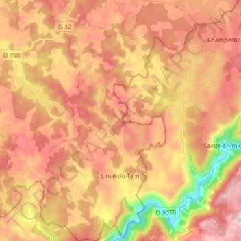
Laval-du-Tarn topographic map
Interactive map
Click on the map to display elevation.
About this map
Name: Laval-du-Tarn topographic map, elevation, terrain.
Average elevation: 863 m
Minimum elevation: 450 m
Maximum elevation: 1,149 m

Click on the map to display elevation.
Name: Laval-du-Tarn topographic map, elevation, terrain.
Average elevation: 863 m
Minimum elevation: 450 m
Maximum elevation: 1,149 m