
Rohtas topographic map
Interactive map
Click on the map to display elevation.
About this map
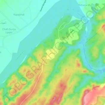
Name: Rohtas topographic map, elevation, terrain.
Location: Rohtas, Tehsil Dina, Jhelum District, Punjab, Pakistan (32.94730 73.55819 32.98730 73.59819)
Average elevation: 275 m
Minimum elevation: 235 m
Maximum elevation: 350 m