
Shivamogga topographic map
Interactive map
Click on the map to display elevation.
About this map
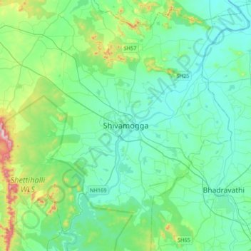
Name: Shivamogga topographic map, elevation, terrain.
Average elevation: 634 m
Minimum elevation: 548 m
Maximum elevation: 1,021 m
Other topographic maps
Click on a map to view its topography, its elevation and its terrain.
Palya
India > Karnataka > Shivamogga taluk
Palya, Shivamogga taluk, Shimoga District, Karnataka, 577202, India
Average elevation: 578 m