
Mururu topographic map
Interactive map
Click on the map to display elevation.
About this map
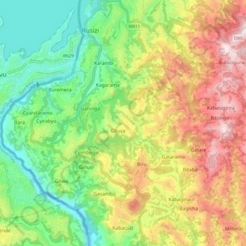
Name: Mururu topographic map, elevation, terrain.
Location: Mururu, Rusizi, Western Province, Rwanda (-2.55778 28.86175 -2.49064 28.95577)
Average elevation: 1,676 m
Minimum elevation: 1,418 m
Maximum elevation: 2,027 m