
Amden topographic map
Interactive map
Click on the map to display elevation.
About this map
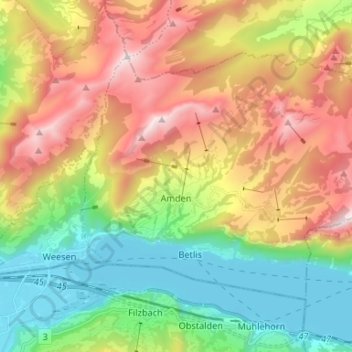
Name: Amden topographic map, elevation, terrain.
Location: Amden, Wahlkreis See-Gaster, Sankt Gallen, 8873, Switzerland (47.12370 9.10596 47.18679 9.23797)
Average elevation: 1,052 m
Minimum elevation: 416 m
Maximum elevation: 1,940 m