Haut-du-Them topographic map
Interactive map
Click on the map to display elevation.
About this map
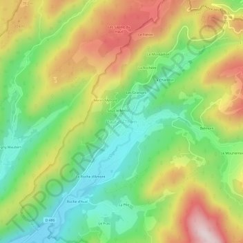
Name: Haut-du-Them topographic map, elevation, terrain.
Average elevation: 610 m
Minimum elevation: 419 m
Maximum elevation: 868 m

Click on the map to display elevation.
Name: Haut-du-Them topographic map, elevation, terrain.
Average elevation: 610 m
Minimum elevation: 419 m
Maximum elevation: 868 m